
Lyndon Station topographic map
Interactive map
Click on the map to display elevation.
About this map
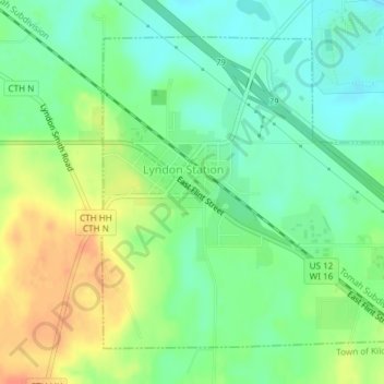
Name: Lyndon Station topographic map, elevation, terrain.
Location: Lyndon Station, Juneau County, Wisconsin, États-Unis (43.69911 -89.90846 43.72102 -89.87827)
Average elevation: 278 m
Minimum elevation: 259 m
Maximum elevation: 305 m