Geolocate

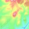
Lake Roberts topographic map

Click on the map to display elevation.

About this map

Name: Lake Roberts topographic map, elevation, terrain.

Location: Lake Roberts, Grant County, New Mexico, United States (33.02773 -108.16519 33.03404 -108.15425)

Average elevation: 1,892 m

Minimum elevation: 1,818 m

Maximum elevation: 1,983 m

Other topographic maps

Click on a map to view its topography, its elevation and its terrain.

Gila Hot Springs

United States > New Mexico > Grant County

Average elevation: 1,823 m

Mimbres

United States > New Mexico > Grant County

Average elevation: 1,881 m

Pinos Altos

United States > New Mexico > Grant County

Average elevation: 2,142 m

Hanover

United States > New Mexico > Grant County

Average elevation: 1,989 m

Fort Bayard

United States > New Mexico > Grant County

Average elevation: 1,878 m

Humbolt Mountain

United States > New Mexico > Grant County

Average elevation: 2,030 m

Loco Mountain

United States > New Mexico > Grant County

Average elevation: 2,285 m

Gear up for your next adventure:

👟Waterproof Leg Gaiters - Keep mud and water out of your boots in boggy terrain
🧼Camping Hygiene Kits - Compact hygiene essentials for outdoor stays
🎒Hiking Child Carriers - Explore the outdoors with the whole family safely
📍Handheld GPS Navigators - Reliable satellite navigation for hiking and off-road exploration
👟Men's Trail Running Shoes - Lightweight grip for fast movement over topographic contours

As an Amazon Associate, this site earns from qualifying purchases at no extra cost to you.