
Jelenica topographic map
Interactive map
Click on the map to display elevation.
About this map
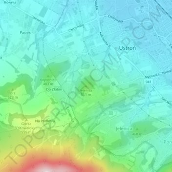
Name: Jelenica topographic map, elevation, terrain.
Average elevation: 441 m
Minimum elevation: 349 m
Maximum elevation: 761 m
Other topographic maps
Click on a map to view its topography, its elevation and its terrain.
Ustroń
Poland > Silesian Voivodeship > Cieszyn County > Ustroń
Ustroń, Cieszyn County, Silesian Voivodeship, 43-450, Poland
Average elevation: 486 m