
Sutton topographic map
Click on the map to display elevation.
About this map
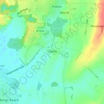
Name: Sutton topographic map, elevation, terrain.
Location: Sutton, Central Bedfordshire, England, United Kingdom (52.09711 -0.25159 52.12442 -0.18669)
Average elevation: 40 m
Minimum elevation: 25 m
Maximum elevation: 76 m
Central Bedfordshire trails, hiking, mountain biking, running and outdoor activities