
Thank you for supporting this site ❤️
Make a donation
Make a donation
Gear up for your next adventure:
As an Amazon Associate, this site earns from qualifying purchases at no extra cost to you.
Cachillacta topographic map
Click on the map to display elevation.
Thank you for supporting this site ❤️
Make a donation
Make a donation
Gear up for your next adventure:
As an Amazon Associate, this site earns from qualifying purchases at no extra cost to you.
About this map
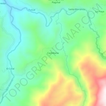
Name: Cachillacta topographic map, elevation, terrain.
Location: Cachillacta, Nanegal, Quito Canton, Pichincha, Ecuador (0.08822 -78.66196 0.12822 -78.62196)
Average elevation: 1,376 m
Minimum elevation: 1,119 m
Maximum elevation: 1,922 m
Thank you for supporting this site ❤️
Make a donation
Make a donation
Gear up for your next adventure:
As an Amazon Associate, this site earns from qualifying purchases at no extra cost to you.