Geolocate

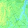
New Bern topographic map

Click on the map to display elevation.

About this map

Name: New Bern topographic map, elevation, terrain.

Location: New Bern, Craven County, North Carolina, United States (34.99573 -77.15870 35.15945 -76.99148)

Average elevation: 5 m

Minimum elevation: -9 m

Maximum elevation: 21 m

Other topographic maps

Click on a map to view its topography, its elevation and its terrain.

Ernul

United States > North Carolina > Craven County

Average elevation: 6 m

Gear up for your next adventure:

🛑Emergency Bivvy Bags - Heat-reflective survival bags for unexpected nights out
🧼Camping Hygiene Kits - Compact hygiene essentials for outdoor stays
🧤Waterproof Overmitts - Extreme weather protection for hikers and mountaineers
🧢Waterproof Hiking Hats - Keep the rain off your face while studying topographic maps
📐Altimeters & Barometers - Tools for measuring altitude and air pressure

As an Amazon Associate, this site earns from qualifying purchases at no extra cost to you.