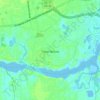
Ernul topographic map
Click on the map to display elevation.
About this map

Name: Ernul topographic map, elevation, terrain.
Location: Ernul, Craven County, North Carolina, United States (35.23266 -77.09967 35.27266 -77.05967)
Average elevation: 6 m
Minimum elevation: -2 m
Maximum elevation: 17 m
Other topographic maps
Click on a map to view its topography, its elevation and its terrain.

New Bern
United States > North Carolina > Craven County
New Bern exhibits a predominantly flat terrain characterized by low-lying areas near its coastal rivers. The city is strategically positioned at the confluence of the Neuse and Trent rivers, where the elevation averages around 10 to 20 feet (3 to 6 meters) above sea level. This coastal setting contributes…
Average elevation: 5 m