Geolocate

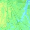
Havelock topographic map

Click on the map to display elevation.

About this map

Name: Havelock topographic map, elevation, terrain.

Location: Havelock, Craven County, North Carolina, United States (34.85483 -76.94854 34.95293 -76.85322)

Average elevation: 8 m

Minimum elevation: -3 m

Maximum elevation: 18 m

Other topographic maps

Click on a map to view its topography, its elevation and its terrain.

Ernul

United States > North Carolina > Craven County

Average elevation: 6 m

Gear up for your next adventure:

🧴Tick Removal Tools - Small, essential health tool for UK woodland and moorland
🐕Hiking Dog Harnesses - Rugged harnesses for taking your companion on mountain trails
🗺️Topographic Maps - Detailed maps showing elevation and terrain features
🧢Waterproof Hiking Hats - Keep the rain off your face while studying topographic maps
🧦Hiking Socks - Breathable socks designed to prevent blisters on long walks

As an Amazon Associate, this site earns from qualifying purchases at no extra cost to you.