Geolocate

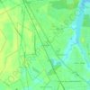
Havelock topographic map

Click on the map to display elevation.

About this map

Name: Havelock topographic map, elevation, terrain.

Location: Havelock, Craven County, North Carolina, United States (34.85483 -76.94854 34.95293 -76.85322)

Average elevation: 8 m

Minimum elevation: -3 m

Maximum elevation: 18 m

Other topographic maps

Click on a map to view its topography, its elevation and its terrain.

Ernul

United States > North Carolina > Craven County

Average elevation: 6 m

Gear up for your next adventure:

🐕Hiking Dog Harnesses - Rugged harnesses for taking your companion on mountain trails
🧭Professional Hiking Compasses - High-precision liquid-filled compasses for map reading and orientation
👟Heavy Duty Boot Laces - Always carry a spare for your hiking footwear
🛌Sleeping Mats - Insulated mats for comfortable outdoor sleeping
🧣Neck Gaiters - Protects against wind and sun on exposed ridges and peaks

As an Amazon Associate, this site earns from qualifying purchases at no extra cost to you.