Geolocate

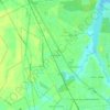
Havelock topographic map

Click on the map to display elevation.

About this map

Name: Havelock topographic map, elevation, terrain.

Location: Havelock, Craven County, North Carolina, United States (34.85483 -76.94854 34.95293 -76.85322)

Average elevation: 8 m

Minimum elevation: -3 m

Maximum elevation: 18 m

Other topographic maps

Click on a map to view its topography, its elevation and its terrain.

Ernul

United States > North Carolina > Craven County

Average elevation: 6 m

Gear up for your next adventure:

🧺Mesh Stuff Sacks - Breathable storage for wet gear or camp organization
🧣Neck Gaiters - Versatile protection against wind and cold
👕Merino Base Layers - Natural temperature regulation for cold weather hiking and camping
🎒Multi-day Trekking Packs - Large capacity backpacks for wild camping and long-distance trails
🔋Solar Chargers - Eco-friendly charging solutions for outdoor use

As an Amazon Associate, this site earns from qualifying purchases at no extra cost to you.