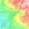
Aparan topographic map
Click on the map to display elevation.
Aparan
Modern-day Aparan is located at the eastern slopes of Mount Aragats and the northern slopes of Mount Ara, on the shores of Kasagh River, with an elevation of 1880 metres above sea level. The town is located at a road distance of 42 km north of Yerevan and 32 km north of the provincial capital Ashtarak, on the main north–south road of Armenia.
About this map

Name: Aparan topographic map, elevation, terrain.
Location: Aparan, Aparan community, Aragatsotn Province, 0301, Armenia (40.57036 44.34473 40.60425 44.37554)
Average elevation: 1,939 m
Minimum elevation: 1,870 m
Maximum elevation: 2,092 m
Other topographic maps
Click on a map to view its topography, its elevation and its terrain.


Oshakan
Oshakan is located in the Kasagh River valley at an altitude of 1,020 meters above sea level. The Kasagh River divides the village into two parts. Administratively, it borders the communities of Voskevaz, Ashtarak, Sasunik, and Dasht. Unofficially, Oshakan is divided into old and new districts.
Average elevation: 1,036 m