
Walker Fold topographic map
Interactive map
Click on the map to display elevation.
About this map
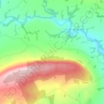
Name: Walker Fold topographic map, elevation, terrain.
Average elevation: 170 m
Minimum elevation: 60 m
Maximum elevation: 343 m
Other topographic maps
Click on a map to view its topography, its elevation and its terrain.
Sabden
Vereinigtes Königreich > England > Lancashire > Ribble Valley
Sabden, Ribble Valley, Lancashire, England, Vereinigtes Königreich
Average elevation: 236 m
Thornley-with-Wheatley
Vereinigtes Königreich > England > Lancashire > Ribble Valley
Thornley-with-Wheatley, Ribble Valley, Lancashire, England, Vereinigtes Königreich
Average elevation: 150 m