Geolocate

Swords topographic map

Click on the map to display elevation.

About this map

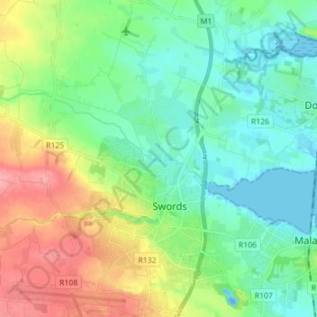
Name: Swords topographic map, elevation, terrain.

Location: Swords, Rowlestown, Fingal, County Dublin, Leinster, Ireland (53.43061 -6.28325 53.51397 -6.16905)

Average elevation: 26 m

Minimum elevation: -19 m

Maximum elevation: 80 m

Gear up for your next adventure:

🥤Hiking Water Bottles - Reusable bottles for hydration on the trail
🌦️Portable Weather Meters - Handheld tools for monitoring weather conditions
🖼️Topographic Map Art - Decorative 3D-effect posters of famous UK peaks and regions
🧤Hiking Gloves - Warm and durable gloves for cold-weather walks
🔭Compact Hiking Binoculars - Lightweight optics for scouting terrain and spotting wildlife

As an Amazon Associate, this site earns from qualifying purchases at no extra cost to you.