
Thank you for supporting this site ❤️
Make a donation
Make a donation
Gear up for your next adventure:
As an Amazon Associate, this site earns from qualifying purchases at no extra cost to you.
Suruhati topographic map
Click on the map to display elevation.
Thank you for supporting this site ❤️
Make a donation
Make a donation
Gear up for your next adventure:
As an Amazon Associate, this site earns from qualifying purchases at no extra cost to you.
About this map
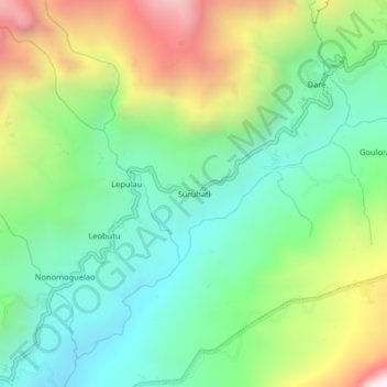
Name: Suruhati topographic map, elevation, terrain.
Location: Suruhati, Hatu-Builico, Ainaro, East Timor (-8.96183 125.52797 -8.92183 125.56797)
Average elevation: 1,184 m
Minimum elevation: 742 m
Maximum elevation: 2,022 m
Thank you for supporting this site ❤️
Make a donation
Make a donation
Gear up for your next adventure:
As an Amazon Associate, this site earns from qualifying purchases at no extra cost to you.