Geolocate

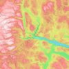
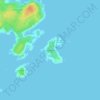
Store Ble topographic map

Click on the map to display elevation.

About this map

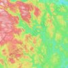
Name: Store Ble topographic map, elevation, terrain.

Location: Store Ble, Tinn, Telemark, Norway (59.80771 9.15247 59.80781 9.15257)

Average elevation: 1,078 m

Minimum elevation: 605 m

Maximum elevation: 1,335 m

Other topographic maps

Click on a map to view its topography, its elevation and its terrain.
Porsgrunn

Norway > Telemark

Average elevation: 87 m

Kragerø

Norway > Telemark

Average elevation: 47 m

Drangedal

Norway > Telemark

Average elevation: 320 m

Vinje

Norway > Telemark

Average elevation: 1,106 m

Nissedal

Norway > Telemark

Average elevation: 500 m

Seljord

Norway > Telemark

Average elevation: 720 m

Tokke

Norway > Telemark

Average elevation: 814 m

Notodden

Norway > Telemark

Notodden has a humid continental climate (Dfb), with cold winters and mild summers. Situated inland at low altitude in the Telemark region, it is one of the warmer towns in Norway during summer. The weather station at Notodden Airport has been recording since March 1970 (temperature and wind speed).…

Average elevation: 553 m
Hjartdal

Norway > Telemark

Average elevation: 796 m

Bordalsvatn

Norway > Telemark

Average elevation: 1,017 m

Seljord

Norway > Telemark

Average elevation: 720 m

Skien

Norway > Telemark

Average elevation: 239 m

Sandane

Norway > Telemark

Average elevation: 625 m

Store Såstein

Norway > Telemark

Average elevation: 3 m

Gear up for your next adventure:

🧺Ultralight Dry Bags - Organize and waterproof your gear inside your rucksack
🔋Lithium AA Batteries - Long-lasting power that performs well in cold mountain weather
🧭Orienteering Compasses - Accurate compasses for map-based navigation
🧼Technical Clothing Wash - Special soap to clean and restore waterproof membranes
🛌Sleeping Mats - Insulated mats for comfortable outdoor sleeping

As an Amazon Associate, this site earns from qualifying purchases at no extra cost to you.