
Uquira topographic map
Interactive map
Click on the map to display elevation.
About this map
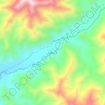
Name: Uquira topographic map, elevation, terrain.
Location: Uquira, Coayllo, Cañete, Lima, Pérou (-12.73223 -76.44209 -12.69223 -76.40209)
Average elevation: 616 m
Minimum elevation: 334 m
Maximum elevation: 1,082 m