
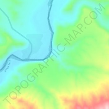
Khir i Kizinzhan topographic map
Interactive map
Click on the map to display elevation.
About this map
Name: Khir i Kizinzhan topographic map, elevation, terrain.
Average elevation: 425 m
Minimum elevation: 354 m
Maximum elevation: 589 m
Other topographic maps
Click on a map to view its topography, its elevation and its terrain.
Asha Spi
Iraq > Sulaimaniya Governorate > Asha Spi
Asha Spi, Bekrejo Subdistrict, Sulaymaniyah District, Sulaimaniya Governorate, Iraqi Kurdistan Region, 46011, Iraq
Average elevation: 750 m