
Ahuatepec topographic map
Interactive map
Click on the map to display elevation.
About this map
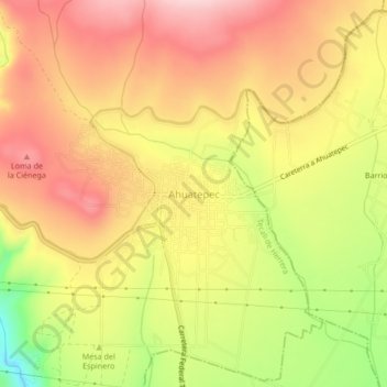
Name: Ahuatepec topographic map, elevation, terrain.
Location: Ahuatepec, Tecali de Herrera, Puebla, 75201, México (18.83917 -97.93556 18.87917 -97.89556)
Average elevation: 2,006 m
Minimum elevation: 1,875 m
Maximum elevation: 2,094 m