
Thank you for supporting this site ❤️
Make a donation
Make a donation
Gear up for your next adventure:
As an Amazon Associate, this site earns from qualifying purchases at no extra cost to you.
Bullsbrook topographic map
Click on the map to display elevation.
Thank you for supporting this site ❤️
Make a donation
Make a donation
Gear up for your next adventure:
As an Amazon Associate, this site earns from qualifying purchases at no extra cost to you.
About this map
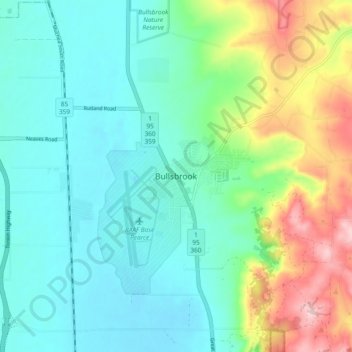
Name: Bullsbrook topographic map, elevation, terrain.
Location: Bullsbrook, Joondalup, Western Australia, 6084, Australia (-31.70374 115.98727 -31.62374 116.06727)
Average elevation: 85 m
Minimum elevation: 24 m
Maximum elevation: 252 m
Thank you for supporting this site ❤️
Make a donation
Make a donation
Gear up for your next adventure:
As an Amazon Associate, this site earns from qualifying purchases at no extra cost to you.