
Shwebo Township topographic map
Interactive map
Click on the map to display elevation.
About this map
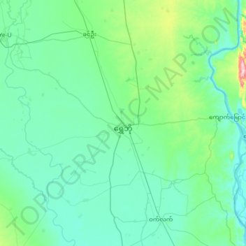
Name: Shwebo Township topographic map, elevation, terrain.
Location: Shwebo Township, Shwebo District, Sagaing, Myanmar (22.44061 95.42377 22.71560 95.99568)
Average elevation: 113 m
Minimum elevation: 65 m
Maximum elevation: 472 m