
Lemiers topographic map
Interactive map
Click on the map to display elevation.
About this map
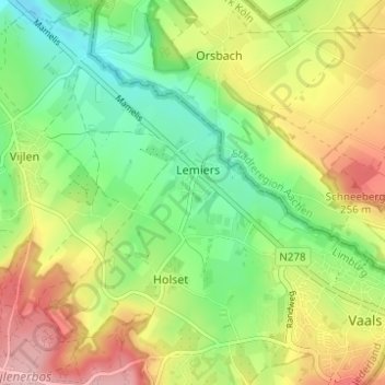
Name: Lemiers topographic map, elevation, terrain.
Location: Lemiers, Vaals, Limburg, Niederlande (50.76439 5.96434 50.80344 6.00099)
Average elevation: 192 m
Minimum elevation: 123 m
Maximum elevation: 285 m