
Thank you for supporting this site ❤️
Make a donation
Make a donation
Gear up for your next adventure:
As an Amazon Associate, this site earns from qualifying purchases at no extra cost to you.
Penteleu topographic map
Click on the map to display elevation.
Thank you for supporting this site ❤️
Make a donation
Make a donation
Gear up for your next adventure:
As an Amazon Associate, this site earns from qualifying purchases at no extra cost to you.
About this map
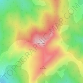
Name: Penteleu topographic map, elevation, terrain.
Location: Penteleu, Gura Teghii, Buzău, Romania (45.60270 26.41684 45.60280 26.41694)
Average elevation: 1,486 m
Minimum elevation: 1,233 m
Maximum elevation: 1,752 m
Thank you for supporting this site ❤️
Make a donation
Make a donation
Gear up for your next adventure:
As an Amazon Associate, this site earns from qualifying purchases at no extra cost to you.