
鼓楼区 topographic map
Interactive map
Click on the map to display elevation.
About this map
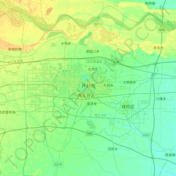
Name: 鼓楼区 topographic map, elevation, terrain.
Location: 鼓楼区, 开封市, 河南省, 中国 (34.63077 114.18662 34.95077 114.50662)
Average elevation: 75 m
Minimum elevation: 66 m
Maximum elevation: 91 m
Other topographic maps
Click on a map to view its topography, its elevation and its terrain.