
Kempston topographic map
Interactive map
Click on the map to display elevation.
About this map
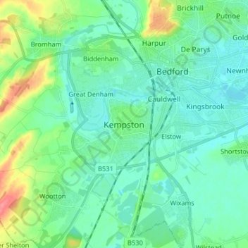
Name: Kempston topographic map, elevation, terrain.
Average elevation: 39 m
Minimum elevation: 23 m
Maximum elevation: 91 m
Other topographic maps
Click on a map to view its topography, its elevation and its terrain.
Addison Howard Park
United Kingdom > England > Kempston
Addison Howard Park, Kempston, Bedford, East of England, England, MK42 8AP, United Kingdom
Average elevation: 33 m