Geolocate

Town of Masonville topographic map

Interactive map

Click on the map to display elevation.

About this map

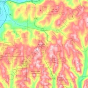
Name: Town of Masonville topographic map, elevation, terrain.

Location: Town of Masonville, Delaware County, New York, United States (42.14941 -75.41994 42.28540 -75.20955)

Average elevation: 503 m

Minimum elevation: 288 m

Maximum elevation: 661 m

Other topographic maps

Click on a map to view its topography, its elevation and its terrain.

Town of Delhi

United States > New York > Delaware County

Average elevation: 585 m

Downsville

United States > New York > Delaware County

Average elevation: 474 m

French Woods

United States > New York > Delaware County

Average elevation: 492 m

Arkville

United States > New York > Delaware County

Average elevation: 542 m

Horton

United States > New York > Delaware County

Average elevation: 499 m

Hobart

United States > New York > Delaware County > Hobart

Average elevation: 531 m

Stamford

United States > New York > Delaware County > Stamford

Average elevation: 598 m