
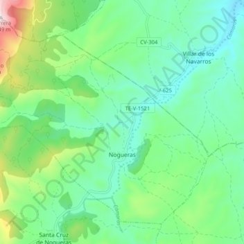
Nogueras topographic map
Interactive map
Click on the map to display elevation.
About this map
Name: Nogueras topographic map, elevation, terrain.
Location: Nogueras, Jiloca, Teruel, Aragon, Spain (41.11829 -1.11765 41.16770 -1.03911)
Average elevation: 915 m
Minimum elevation: 765 m
Maximum elevation: 1,338 m
Other topographic maps
Click on a map to view its topography, its elevation and its terrain.