Geolocate

Banani topographic map

Interactive map

Click on the map to display elevation.

About this map

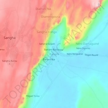
Name: Banani topographic map, elevation, terrain.

Location: Banani, Bandiagara Cercle, Mopti, Mali (14.44227 -3.30941 14.48227 -3.26941)

Average elevation: 413 m

Minimum elevation: 301 m

Maximum elevation: 549 m

Other topographic maps

Click on a map to view its topography, its elevation and its terrain.

Gouna

Mali > Mopti > Bandiagara Cercle

Gouna, Bandiagara Cercle, Mopti, Mali

Average elevation: 321 m

Bandiagara

Mali > Mopti > Bandiagara Cercle

Bandiagara, Bandiagara Cercle, Mopti, Mali

Average elevation: 436 m