
Diên Sanh topographic map
Interactive map
Click on the map to display elevation.
About this map
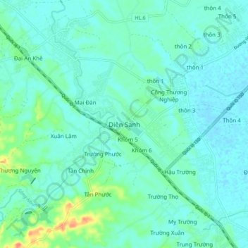
Name: Diên Sanh topographic map, elevation, terrain.
Location: Diên Sanh, Hải Lăng District, Quang Tri province, Vietnam (16.65305 107.20580 16.73305 107.28580)
Average elevation: 9 m
Minimum elevation: -3 m
Maximum elevation: 47 m
Other topographic maps
Click on a map to view its topography, its elevation and its terrain.
Lương Sơn
Vietnam > Quang Tri province > Hải Lăng District
Lương Sơn, Hải Lăng District, Quang Tri province, Vietnam
Average elevation: 8 m