
Jinotega (Municipio) topographic map
Interactive map
Click on the map to display elevation.
About this map
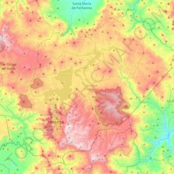
Name: Jinotega (Municipio) topographic map, elevation, terrain.
Location: Jinotega (Municipio), Jinotega, 65000, Nicaragua (12.99428 -86.11693 13.34088 -85.72032)
Average elevation: 962 m
Minimum elevation: 338 m
Maximum elevation: 1,654 m
Other topographic maps
Click on a map to view its topography, its elevation and its terrain.