Casteau topographic map
Click on the map to display elevation.
Casteau
The valley of the Obrecheuil is in the east of the village. This part of the valley is part of Natura 2000 protected areas. The heart of the village is in the northwest higher part of the valley. The northwestern part of the village is a plain with dispersed houses and farms with typical hedges. The village is the border between the valley of The Haine (Elevation from 20 to 30m) and the plateau of Hainaut (elevation from 80 to 150 m).
About this map
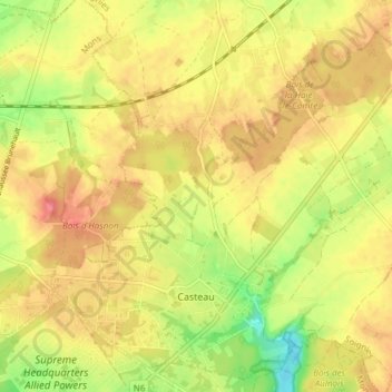
Name: Casteau topographic map, elevation, terrain.
Location: Casteau, Soignies, Hainaut, Wallonia, Belgium (50.50423 3.97527 50.54626 4.05069)
Average elevation: 98 m
Minimum elevation: 58 m
Maximum elevation: 125 m
Other topographic maps
Click on a map to view its topography, its elevation and its terrain.