
Kanda topographic map
Interactive map
Click on the map to display elevation.
About this map
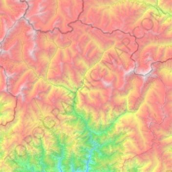
Name: Kanda topographic map, elevation, terrain.
Location: Kanda, Saipal, Bajhang, Sudurpashchim Pradesh, Nepal (29.65924 80.99816 30.05328 81.56482)
Average elevation: 4,305 m
Minimum elevation: 1,482 m
Maximum elevation: 6,996 m
Other topographic maps
Click on a map to view its topography, its elevation and its terrain.