
Phou Phathi topographic map
Interactive map
Click on the map to display elevation.
About this map
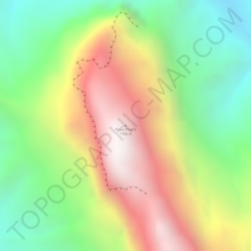
Name: Phou Phathi topographic map, elevation, terrain.
Location: Phou Phathi, Xam Neua District, Houaphanh, Laos (20.46988 103.70613 20.46998 103.70623)
Average elevation: 1,049 m
Minimum elevation: 490 m
Maximum elevation: 1,677 m