Geolocate

Azinhal topographic map

Click on the map to display elevation.

About this map

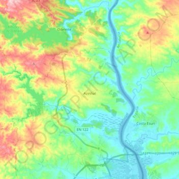
Name: Azinhal topographic map, elevation, terrain.

Location: Azinhal, Castro Marim, Faro, 8950-032, Portugal (37.25114 -7.59505 37.32417 -7.42169)

Average elevation: 65 m

Minimum elevation: -2 m

Maximum elevation: 206 m

Other topographic maps

Click on a map to view its topography, its elevation and its terrain.

Praia Verde

Portugal > Faro > Castro Marim

Average elevation: 7 m

Gear up for your next adventure:

🔦Head Torches - Hands-free lighting for hiking and camping
👕Merino Base Layers - Natural temperature regulation for cold weather hiking and camping
🧥Waterproof Hiking Jackets - Rain protection for walking in all weather conditions
🖼️Topographic Map Art - Decorative 3D-effect posters of famous UK peaks and regions
🧼Camping Hygiene Kits - Compact hygiene essentials for outdoor stays

As an Amazon Associate, this site earns from qualifying purchases at no extra cost to you.