
潞江镇 topographic map
Interactive map
Click on the map to display elevation.
About this map
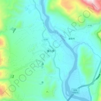
Name: 潞江镇 topographic map, elevation, terrain.
Location: 潞江镇, 保山市, 云南省, 中国 (24.93127 98.82952 25.01127 98.90952)
Average elevation: 898 m
Minimum elevation: 657 m
Maximum elevation: 1,950 m
Other topographic maps
Click on a map to view its topography, its elevation and its terrain.