
Oxenford topographic map
Interactive map
Click on the map to display elevation.
About this map
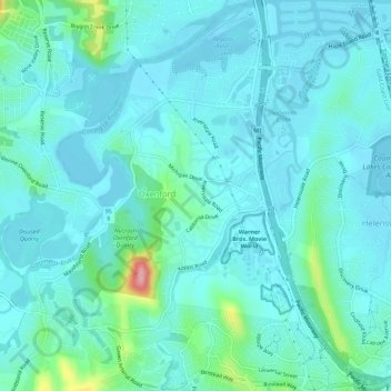
Name: Oxenford topographic map, elevation, terrain.
Location: Oxenford, Gold Coast City, Queensland, Australia (-27.92678 153.27696 -27.87686 153.32955)
Average elevation: 21 m
Minimum elevation: -2 m
Maximum elevation: 144 m
Other topographic maps
Click on a map to view its topography, its elevation and its terrain.