
Panecillo topographic map
Interactive map
Click on the map to display elevation.
About this map
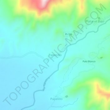
Name: Panecillo topographic map, elevation, terrain.
Location: Panecillo, Chulucanas, Morropón, Piura, Perú (-5.07144 -80.12078 -5.03144 -80.08078)
Average elevation: 207 m
Minimum elevation: 119 m
Maximum elevation: 582 m