
West Ocean City topographic map
Interactive map
Click on the map to display elevation.
About this map
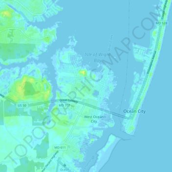
Name: West Ocean City topographic map, elevation, terrain.
Location: West Ocean City, Worcester County, Maryland, United States (38.30891 -75.13410 38.38230 -75.09310)
Average elevation: 2 m
Minimum elevation: -6 m
Maximum elevation: 16 m