
Make a donation
Gear up for your next adventure:
As an Amazon Associate, this site earns from qualifying purchases at no extra cost to you.
Yushan topographic map
Click on the map to display elevation.
Make a donation
Gear up for your next adventure:
As an Amazon Associate, this site earns from qualifying purchases at no extra cost to you.
Yushan
Yu Shan or Yushan, also known as Mount Jade, Jade Mountain, or Mount Yu, and known as Mount Niitaka during Japanese rule, is the highest mountain in Taiwan at 3,952 m (12,966 ft) above sea level, giving Taiwan the 4th-highest maximum elevation of any island in the world. It is the highest point in the western Pacific region outside of the Kamchatka Peninsula. Yushan and its surrounding mountains belong to the Yushan Range. The area was once in the ocean; it rose to its current height because of the Eurasian Plate's movement over the Philippine Sea Plate.
Make a donation
Gear up for your next adventure:
As an Amazon Associate, this site earns from qualifying purchases at no extra cost to you.
About this map
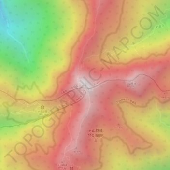
Name: Yushan topographic map, elevation, terrain.
Location: Yushan, Xinyi Township, Nantou County, Taiwan (23.46994 120.95722 23.47004 120.95732)
Average elevation: 3,411 m
Minimum elevation: 2,530 m
Maximum elevation: 3,930 m
Make a donation
Gear up for your next adventure:
As an Amazon Associate, this site earns from qualifying purchases at no extra cost to you.