
Huai topographic map
Interactive map
Click on the map to display elevation.
About this map
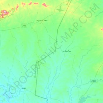
Name: Huai topographic map, elevation, terrain.
Location: Huai, Amnat Charoen Province, Thailand (15.62922 104.78511 15.94922 105.10511)
Average elevation: 158 m
Minimum elevation: 119 m
Maximum elevation: 338 m
Other topographic maps
Click on a map to view its topography, its elevation and its terrain.
Ban Kai Kham
Thailand > Amnat Charoen Province
Ban Kai Kham, Kai Kham, Amnat Charoen Province, 37000, Thailand
Average elevation: 149 m