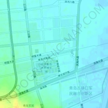
青岛古镇口军民融合创新区 topographic map
Interactive map
Click on the map to display elevation.
About this map
Name: 青岛古镇口军民融合创新区 topographic map, elevation, terrain.
Average elevation: 4 m
Minimum elevation: -3 m
Maximum elevation: 21 m

Click on the map to display elevation.
Name: 青岛古镇口军民融合创新区 topographic map, elevation, terrain.
Average elevation: 4 m
Minimum elevation: -3 m
Maximum elevation: 21 m