
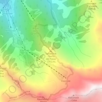
Sattelnock - Corno del Passo topographic map
Interactive map
Click on the map to display elevation.
About this map
Name: Sattelnock - Corno del Passo topographic map, elevation, terrain.
Average elevation: 2,149 m
Minimum elevation: 1,530 m
Maximum elevation: 2,912 m
Other topographic maps
Click on a map to view its topography, its elevation and its terrain.
Steinhaus - Cadipietra
Italy > Trentino-Alto Adige/Südtirol > South Tyrol > Ahrntal - Valle Aurina
Average elevation: 1,491 m