
Kotido topographic map
Interactive map
Click on the map to display elevation.
About this map
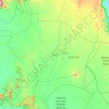
Name: Kotido topographic map, elevation, terrain.
Location: Kotido, Northern Region, Uganda (2.61942 33.54978 3.36971 34.39681)
Average elevation: 1,250 m
Minimum elevation: 969 m
Maximum elevation: 2,353 m
Other topographic maps
Click on a map to view its topography, its elevation and its terrain.