
Decatur topographic map
Interactive map
Click on the map to display elevation.
About this map
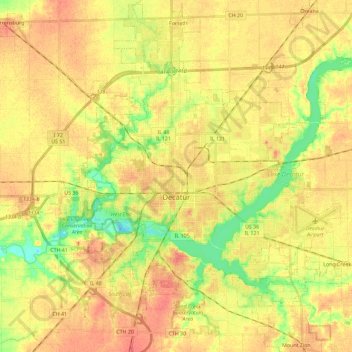
Name: Decatur topographic map, elevation, terrain.
Location: Decatur, Macon County, Illinois, United States (39.78680 -89.03237 39.92496 -88.80320)
Average elevation: 205 m
Minimum elevation: 177 m
Maximum elevation: 224 m
Other topographic maps
Click on a map to view its topography, its elevation and its terrain.
Maroa
United States > Illinois > Macon County
Maroa, Macon County, Illinois, 61756, United States
Average elevation: 216 m