
Challakere topographic map
Click on the map to display elevation.
Challakere
Challakere is located at 14°18′43″N 76°39′04″E / 14.312°N 76.651°E / 14.312; 76.651. It has an average elevation of 585 metres (1919 ft).
About this map
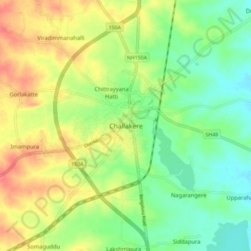
Name: Challakere topographic map, elevation, terrain.
Average elevation: 583 m
Minimum elevation: 559 m
Maximum elevation: 613 m