
Thank you for supporting this site ❤️
Make a donation
Make a donation
Gear up for your next adventure:
As an Amazon Associate, this site earns from qualifying purchases at no extra cost to you.
A'na topographic map
Click on the map to display elevation.
Thank you for supporting this site ❤️
Make a donation
Make a donation
Gear up for your next adventure:
As an Amazon Associate, this site earns from qualifying purchases at no extra cost to you.
About this map
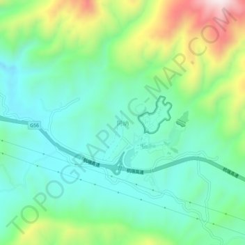
Name: A'na topographic map, elevation, terrain.
Location: A'na, Lufeng County, Chuxiong, Yunnan, China (24.95684 102.04701 24.99684 102.08701)
Average elevation: 1,663 m
Minimum elevation: 1,492 m
Maximum elevation: 2,078 m
Thank you for supporting this site ❤️
Make a donation
Make a donation
Gear up for your next adventure:
As an Amazon Associate, this site earns from qualifying purchases at no extra cost to you.