
Rossman topographic map
Interactive map
Click on the map to display elevation.
About this map
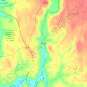
Name: Rossman topographic map, elevation, terrain.
Average elevation: 43 m
Minimum elevation: -4 m
Maximum elevation: 70 m
Other topographic maps
Click on a map to view its topography, its elevation and its terrain.
Stottville
United States > New York > Columbia County > Town of Stockport
Stottville, Town of Stockport, Columbia County, New York, 12172, United States
Average elevation: 46 m
Columbiaville
United States > New York > Columbia County > Town of Stockport
Columbiaville, Town of Stockport, Columbia County, New York, 12050, United States
Average elevation: 32 m