Geolocate

Manong topographic map

Interactive map

Click on the map to display elevation.

About this map

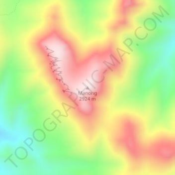
Name: Manong topographic map, elevation, terrain.

Location: Manong, Maseru District, Lesotho (-29.69425 28.04075 -29.69415 28.04085)

Average elevation: 2,688 m

Minimum elevation: 2,449 m

Maximum elevation: 2,926 m

Other topographic maps

Click on a map to view its topography, its elevation and its terrain.

Morija

Lesotho > Maseru District

Morija, Maseru District, Lesotho

Average elevation: 1,767 m

PTC

Lesotho > Maseru District > Maseru

PTC, Maseru, Maseru District, 100, Lesotho

Average elevation: 1,649 m

Maqalika Dam

Lesotho > Maseru District > Maseru

Maqalika Dam, Maseru, Maseru District, 100, Lesotho

Average elevation: 1,540 m

Maseru

Lesotho > Maseru District

Maseru, Maseru District, 100, Lesotho

Average elevation: 1,606 m