
Thank you for supporting this site ❤️
Make a donation
Make a donation
Gear up for your next adventure:
As an Amazon Associate, this site earns from qualifying purchases at no extra cost to you.
Lakhani topographic map
Click on the map to display elevation.
Thank you for supporting this site ❤️
Make a donation
Make a donation
Gear up for your next adventure:
As an Amazon Associate, this site earns from qualifying purchases at no extra cost to you.
About this map
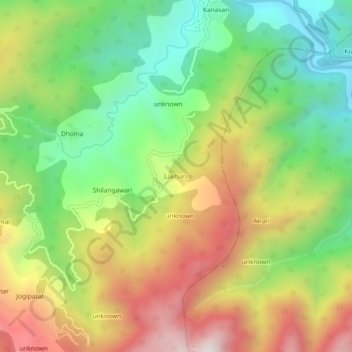
Name: Lakhani topographic map, elevation, terrain.
Location: Lakhani, Garud, Bageshwar District, Uttarakhand, 263641, India (29.84914 79.63464 29.88914 79.67464)
Average elevation: 1,438 m
Minimum elevation: 1,039 m
Maximum elevation: 1,948 m
Thank you for supporting this site ❤️
Make a donation
Make a donation
Gear up for your next adventure:
As an Amazon Associate, this site earns from qualifying purchases at no extra cost to you.