
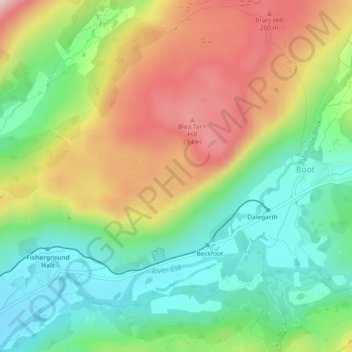
Blea Tarn topographic map
Interactive map
Click on the map to display elevation.
Blea Tarn
Blea Tarn is a lake in Eskdale, Cumbria, in the English Lake District, located about half a mile north of Beckfoot. Located at an elevation of 217 m (712 ft), the lake has an area of 3.3 hectares (8.2 acres) and measures 277 m × 150 m (909 ft × 492 ft), with a maximum depth of 11 m (36 ft).
About this map
Name: Blea Tarn topographic map, elevation, terrain.
Average elevation: 144 m
Minimum elevation: 23 m
Maximum elevation: 312 m