Geolocate

Montrose topographic map

Click on the map to display elevation.

About this map

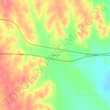
Name: Montrose topographic map, elevation, terrain.

Location: Montrose, Jewell County, Kansas, United States (39.76446 -98.10783 39.80446 -98.06783)

Average elevation: 513 m

Minimum elevation: 471 m

Maximum elevation: 549 m

Gear up for your next adventure:

🧥Softshell Jackets - Breathable jackets for active outdoor use
🎒Replacement Sternum Straps - Repair parts for hiking rucksacks
🧤Waterproof Overmitts - Extreme weather protection for hikers and mountaineers
🐕Hiking Dog Harnesses - Rugged harnesses for taking your companion on mountain trails
🎒Hiking Daypacks (20L) - Compact backpacks for day trips and technical mountain ascents

As an Amazon Associate, this site earns from qualifying purchases at no extra cost to you.